Who Am I?

My photo
A nobody; a nitwit; a pilot; a motorcyclist; a raconteur; a lover...of life - who loves to laugh, who tries to not take myself (or anything) too seriously...just a normal guy who knows his place in the universe by being in touch with my spiritual side. What more is there?

26 June 2011

Cherry Drying By Helicopter

Well the big cherry drying adventure isn’t going so well. I’ve been up here in Brewster, Washington for a month now and we haven’t dried a single cherry yet. Normally we’re drying by now. Blame it on the weather, which is gorgeous. The early spring was unusually cool...or wet...or hot...or dry...or something. I'm a city boy; I don't know anything about cherries. The end result is that the cherries are late. Problem is, July can be hot and dry. If there’s not much rain we won’t be flying much. Good for me, since I’ve done just about all the flying I ever want to do in my lifetime. But bad for the boss. Standby time is good, but he relies on the extra revenue that the flight time would generate.

The contract I’m on is for a grower just north of Brewster. I’ve got a motor home parked right next to the helicopter. Everything is in position and we’re sitting on “go.” A young pilot named Travis will be flying with me for the first week or so, when a second helicopter comes online for this customer. Then he’ll fly one and I’ll fly the other. Travis has done this before. With just 1,200 hours he’s relatively low-time compared to me, but he’s a very competent, professional pilot who knows the ropes and can show this old timer how to do the job.

It’s a little odd being the new guy. I may have a lot of total flight time, but very little time in the S-55, which to my surprise and dismay turns out to be a fairly unpleasant helicopter to fly. (Let’s just say helicopter design has come a loooooong way in 50 years.) Every new task brings with it a learning curve. I don’t like being on the upside of it before it levels out. Don’t get me wrong - cherry drying is not difficult. I mean, all we do is hover over the trees and blow the water off. But you can’t hover too high or move forward too fast. You have to find a “sweet spot” where you’re shaking the water off the cherries without damaging the branches. The farmers usually watch and bark higher!/lower!/too fast!/too slow! orders at us over a portable two-way radio.

In this regard, the Sikorsky S-55 helicopter is perfect for this job: It’s got tons of spare power, and the big, slow-turning three-blade rotor produces a gentle downwash. We can dry up to four rows of trees at a time. There are bigger and smaller helicopters employed by the growers. Each has its advantages and disadvantages. Although one wonders just how effective the miniscule Robinson R-22s and R-44s (trainer helicopters) can be, drying one row at a time, if that. I guess they’re good for small groves, or perhaps for farmers who like to waste money. The roaring S-55 puts them all on the trailer.

So that’s where we stand. I’ve had a great month of goofing off and getting paid for it (which is my specialty, of course), hanging out with my friend Mikey and the great people I work with, and riding my motorcycle on some wonderful roads through some of the most gorgeous scenery ever invented. Now it’s time to get to work, I guess.

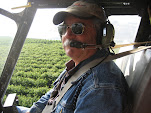
Travis flying the S-55 back to Brewster from the radio shop in Wenatchee, Washington.

The S-55 in a field by a road where it'll spend the next 45 days.

14 June 2011

Florida To Washington By Motorcycle: The Home Stretch

The third and fourth days of my trip from Pensacola to Brewster were, shall we say, challenging. But that’s part of being a motorcyclist. If you’re going to call yourself one, then you cannot restrict your riding to nice, sunny days. Sometimes you’re gonna get wet. And cold. Goes with the territory. I was actually prepared for such conditions. But the best rainsuit and the warmest clothes are of no use if they’re packed away in your luggage when the weather changes. I had kept my rainsuit handy, and in fact did need it often, but I hadn’t dressed nearly warmly enough when I got to the Rocky Mountains.

After freezing my ass off most of the way through Montana, Wyoming and Idaho on Tuesday, I corrected that for the final stretch. I knew it wasn’t going to get any warmer until I got west of Spokane. And it didn’t.


Butte, Montana to Brewster, Washington is only 450 miles. Wednesday morning dawned cloudy but reasonably rain free. The weather forecast was good. Despite the trials and tribulations of the previous day, I was actually in a pretty good mood. Leaving the rainsuit off, I put on my appropriate cold weather gear and headed out fairly early. Such a difference from the day before! Even though we were still 5,000 feet or so above sea level and the temps were down in the 30’s, I was toasty and comfortable, making good time and having a great time. I was able to remember why it was I took the bike on this trip and not the car. I called Mikey from Missoula and told him I’d be at his place around 4:30. This was one estimate I was confident I could make.

The route to Brewster passes the Grand Coulee Dam and, further downstream, the Chief Joseph Dam. Because dams fascinate me for some reason, I had to stop at both. Luckily there were some showers in my way that needed some waiting-out anyway. Not big enough to have to put the rainsuit on, but big enough to hang out and let them move on.

As it turned out, even with my lingering at the two dams, I pulled into the Brewster Airport right around 4:15. I was tired and glad to be at the destination. It had been a hell of a trip. Mikey met me at the airport and we went out to the Sweet River Bakery in Pateros, the next town over for a celebratory meal (with maybe a little too much wine). As you can imagine, I slept like a log that night.

And so the Summer of Bob begins!

This is me, standing in front of one of a Sikorsky S-55 owned by Golden Wings Aviation, my employer for the summer. It is one year older than I am. It is the same type of helicopter my father flew in the 1950's when he was in the U.S.M.C.

09 June 2011

Florida to Washington By Motorcycle: Over The Peaks And Into The Depths (Part 4)

So the tale of this trip is taking longer to tell than it was to actually do. If you’ve read the first three installments, you’ll know that I had pretty good weather for the first half of my trip from Pensacola, Florida to Brewster, Washington. Then things kind of went sour. The bike, which I had been worried about, performed flawlessly. The weather and the roads, which I had not been worried about, turned nasty. How could it get worse, you ask? Ah, I’d forgotten about those dang ol’ Rocky Mountains…

I knew Tuesday (my third day on the road) would be rainy, but I naively did not expect it to be very cold. So when starting out from Gillette, Wyoming I didn’t dress as warmly as I should have. Turned out to be a near-fatal mistake. We got diverted off the Interstate and through the Bighorn National Forest and I found myself riding across snow-covered passes. Damn, it was cold. Finally back up and westbound on I-90, it poured rain but the temperatures didn’t seem so bad. It was 3 p.m. or so when I stopped for gas in Big Timber, Montana ("A" on the map below) and I had 260-something miles to go to Missoula ("B" on map below). Four hours, maybe five. I could make Missoula by sunset, and then it’s an easy hop from Missoula to Brewster.


Now, in this area of Montana I-90 generally rides along a plain that is about 3,500 to 4,500 feet above sea level. We all know that temperature drops the higher you go, and it was getting noticeably “chilly.” I probably should have been paying more attention to the topography. My bad, as the kids say.

Once you get past Livingston, Montana you have to cross over a little mountain range where the peaks are up around 10,000 feet. I went through Bozeman Pass, which the FAA chart says is at 5,718 feet, and it was cold. Really cold. You only drop down a little into the city of Bozeman, which sits at 4,820 feet. Not quite as high as Denver (5,130 feet), but almost. I should have stopped there for the night, but stupidly I pressed on.

West of Bozeman, the terrain gets higher. The cold was starting to get to me. The face shield on my helmet began fogging up badly on the inside. Opening it even a crack was extremely uncomfortable due to the cold. The steady rain was putting water on the outside of the shield as usual. The combination of water on the outside and fog on the inside was making it really hard to see. My “waterproof” gloves turned out to be not-so and my hands were freezing. The road through the mountains was challenging, and I was concentrating hard on not crashing. The best speed I could maintain was around 60. Faster than that was just too damn cold. I knew I had screwed up.

After crossing the Continental Divide I was going down this one hill/curve – a long, sweeping right-hander just east of Butte – when I inadvertently allowed the bike to drift wide into the left lane (no turn signal, of course). I was not riding well. Correcting as best I could, I eased back toward the right lane – again, no turn signal – just as a pickup truck came roaring down the hill to pass me on the right. I looked in my left mirror, which I could barely see anyway, thinking I would get back in the left lane, but there was a car right there that was about to pass me on the left. These guys were hauling ass too. The guy behind me jammed on his brakes, but I wasn’t at all sure he was going to be able to slow down in time. I thought it was all over. At the last second, the car on my left eased by and the pickup truck swerved over into that lane, missing me by inches. I’m telling you, it was close. My heart was in my throat.

At the bottom of the hill I took the first exit. I had to get gas anyway. At the pump, I could barely get my Visa into the card reader, my hand was shaking badly. I thought at first it was because I’d just scared myself, but I soon realized that my whole body was convulsing uncontrollably from the cold. I went inside to warm up, but the shaking would not stop. I was having trouble moving, and my brain didn't seem to be working right (yes, yes, you're asking "How could you tell?"). I don’t think I’ve ever been colder in my entire life – and I grew up in New York City so I know a thing or two about cold weather. In Butte, I was experiencing mild to moderate hypothermia. The clerk said, “Dude, you look terrible. Get a cup of coffee or something and warm up.” I abandoned any thought of going further, the one good idea I'd had all day.

It took about thirty minutes or so before I warmed up to even be functional enough to get back on the bike. The gas station clerk let me drink as much of his coffee as I wanted and - again - wouldn't take any money. It turned out there was a Days Inn right next to the gas station. I stumbled in and luckily, they had an indoor hot tub and a guest laundry, and I took full advantage of both. Then I crashed for the night - in a bed and not on the highway. It had been one friggin' rough day.

And there was still one more to go.

07 June 2011

Florida to Washington By Motorcycle: It Gets Worse (Part 3)

Our story so far: An intrepid-if-stupid blogger who shall remain nameless (me) thought it would be "fun" to travel from Pensacola, Florida to Brewster, Washington - a total of 2,600+ miles - on a Harley-Davidson Sportster motorcycle. Easy-peasy three-day trip! Um...not.

TUESDAY, May 24, 2011
Once I was done with the challenge of crossing Bighorn National Forest on one of their late-season snow days (see previous post), I thought it would be clear sailing up Hwy 310 to Laurel where I’d reconnect with I-90. Heh. Foolish boy…

From Greybull, you go north on 310 through the towns of Lovell, Cowell, Deaver and Frannie. Passing through Lovell I saw a sign that said,


“Rte 310 Under Construction, 20 Miles. Motorcyclists Consider Alternate Route.”

Wait... What? I thought I was already on the alternate route! The rain was now so heavy that I really couldn’t stop to pull out a map to find yet another alternate. Plus, I missed that bit about 20 miles of construction. I figured after Bighorn, how bad could it be?

Rte 310 from the Wyoming/Montana border north to the town of Bridger is not really a road. If you look on Google Maps they do show a road, especially if you zoom down to the street view- they show a narrow, paved two-lane road. But trust me, there is no road there anymore.

Evidently Montana had chosen the Spring of 2011 to re-do the ENTIRE road. They tore it up, built it up higher and made it wider. Then they graded it with a bulldozer. You know the staccato vibration your car makes when you go down a road over the evenly spaced ruts from the tracks of a bulldozer? Imagine 20 miles of that at 30 mph. On a motorcycle. In heavy rain. I thought the bike might actually come apart…disassemble itself out in the middle of nowhere. And actually, it almost did.

The road was wide enough - almost four lanes wide now, so I kept hunting for a clear track. But the traffic was actually pretty heavy, what with all of us that were detoured off I-90 in the first place. The 18-wheelers routinely doused me with mud. The "road" was more slippery than greased baby snot and my tires fought for traction. But at least I was now heading in the right direction! (That’s an optimist for you.)

At one point, I heard a clanking and looked down to see my sidestand flapping in the breeze. The little spring that keeps it folded up was gone. Shit! I pulled over and stopped. I saw that I could put a bungee cord on it to keep it secured (which is what I did), but I’d have to replace the spring and had no idea where the nearest Harley dealer was. So I walked back, retracing my steps. To my amazement, I saw the spring lying there in the middle of the road not too far back. Waiting for a lull in the traffic, I retrieved it and put it in my pocket. No way to put it back on without tools. And I didn’t have any.

A woman construction worker came over. “You broke down?” I told her no, and showed her what happened. “Well there’s a gas station with a garage up in Bridger,” she offered. How far? “Ohhhh, still about ten miles.” Great. I wanted to take a picture of the mess, but it was raining so heavily that I didn’t want to pull my camera out. I just got back on the bike and soldiered on. The handlebars felt like I was holding a jackhammer. I'll tell ya, sometimes it's hard to maintain a sense of humor about things.

It was still pouring when I finally made Bridger. Even so, I stopped at one of those self-service car washes and hosed off the bike. And my boots. And my rainsuit. And my luggage. I found the reported gas station/tire store. The proprietor quickly told me to pull it in. He went to the adjacent convenience store and got me a cup of hot coffee – on the house. His mechanic had the spring back in place in no time, and they wouldn’t take any money for it. I must have looked really pathetic. With the bike fixed, I had some convenience store lunch and was back on my way.

After the cold and snow of Bighorn National Forest, and the horribly rough road and slippery mud of Hwy 310 back up to the Interstate, the heavy rain as I traveled westbound was not a problem. In fact, it was kind of comforting in a way: It was only rain. But it was incessant. And I knew it wasn’t going to let up. And it was cold, but not that cold.

Around three p.m. I stopped for gas at Big Timber, Montana, just an interchange with a truck stop/casino/motel. While waiting for Mikey to return a phone call (gotta love phone tag), I stood in the vestibule of the big complex, thankful for the chance to be out of the rain for a bit. A car pulled in and a young guy, obviously a local kid hopped out. As he entered the vestibule he noticed me and asked, somewhat rhetorically if I was waiting out the rain.

“Yeah,
I said casually. “I think it’s only a little shower. It should be clearing up soon and I’ll be on my way.” Mind you, it was pouring like a cow doing you-know-what on a flat rock at the time.

The kid didn’t say anything for a while. He just stared at me as if I had come from another planet. Finally he looked outside and said, really skeptically and slowly, “Mister…I…don’t…think…this…rain…is…gonna…stop. It’s been raining like this here for three days! There are flood advisories for counties all around here!”

I knew that, of course (well not the flood advisories but I was not surprised). But what are you gonna do? Continuing my little joke, I expressed my doubts about what he’d said, assuring him that it would be clearing very soon. He just shook his head and went inside. Shortly afterward, he showed up at the cashier which was right inside the door. She was facing away from me, so I did not hear her question to him. But I heard the boy’s incredulous response.
“Yeah, he’s waiting out the rain. He thinks it’s just a shower! And that it’s going to stop soon!” And then I heard a bunch of people laugh. So there must’ve been more than just him and the cashier at the counter.

Mikey never did call me back, the bastard. So I saddled up and headed out again. I thought I was through the worst of it and that I might make Missoula, Montana - only 265 miles ahead - by dusk. God had other plans though. And they weren’t good. This day wasn't done with me yet. Incredibly, the worst was yet to come.


06 June 2011

Florida to Washington By Motorcycle: The Weather Hammer Drops

Dear God: Why do you hate me?

The first three days of the trip so far had been absolutely perfect for a motorcyclist: Clear skies and cool temps. But by the time I pulled into my stop for the third night in Gillette, Wyoming, I knew my luck was about to run out. I’d been watching the weather, as we pilots and motorcyclists do. I knew there was rain ahead. If only…


I have a good rainsuit. Westbound out of Gillette, I had it on but only experienced light showers. I got just past the town of Sheridan before I saw a sign that said, “Interstate 90 closed ahead. All traffic must exit. Use Rt 14 westbound.” I was like, WTF? They close the Interstates up here? Indeed they do. Westbound was not the direction I needed to be going.

The Buffalo River had flooded way up at the town of Hardin, Montana, some 66 miles ahead. There really aren’t any alternate routes, so they kicked us off the Interstate at the town of Ranchester, just south of the Montana border. Highway 14 took us through the Bighorn National Forest.

Our little detour. If you click on the image it'll open bigger. See that road about halfway through the Bighorn National Forest that looks like a shortcut over to the town of Lovell? Yeah...it was closed due to the heavy snowfall. The detour added nearly 60 miles of bad road to the trip. Doesn't seem like a lot, right?

It was raining steadily now. My paper map showed us heading way off to the southwest, when I really needed to be going almost straight northbound. Just past the town of Dayton we started up a steep grade with lots of switchbacks. Dear God, it was slippery. I thought to myself, “This is not good.” One complication was that I do not have a smart-phone, only a very, very dumb one. This was a calculated risk, as it would have been nice to be able to get online and see the current weather and figure out a better alternate route.

I hoped it would be a quick up-and-over a pass, but we just kept climbing and climbing. And it got colder and colder. I could see we were climbing up into a cloud deck. Soon, visibility dropped to a couple of hundred feet. There was snow falling, snow on the ground all around me and, occasionally, snow on the road. To say I was dispirited would be the understatement of the year. I really wasn’t prepared to ride in snow.

A satellite view of the road through the Bighorn National Forest (obviously taken in the Spring or Summer). Silly me for thinking I'd be through it quickly.

We’d ascend, and then descend a little and I’d get my hopes up. But then we’d ascend again. The FAA chart of the area shows peaks of 10,000 feet. The road doesn’t go across the tops of the peaks of course, but we weren’t too far from the top. I saw one of those elevation signs that said something like 8,000 feet. I was too cold to stop and take a picture. And we were not yet on the way down. All I could do was ride as carefully as I could, hoping I didn’t drop the bike on one of the sharp curves. The scenic turnoffs were all closed and impassable due to the snow.

ABOVE: About halfway up the pic, where the horizon ought to be, are clouds and snow-covered mountains hidden behind them. This was the first chance I had to pull over and take a picture.

This was what it was like for most of the trip through the B.H. National Forest. Except sometimes it was snowing more heavily (which you can't see in the pic).


In the two pictures above, I had descended below the snow line. The pictures can't communicate how cold it was. I was just happy to be out of the clouds and snow.

After what seemed like forever, we descended into the "town" of Shell (which isn't, really), then further down to Greybull where it really started raining again. It’s funny, 50 degrees seemed so cold just a few hours earlier. Now, 50 in a steady rain felt like summer in the friggin’ Bahamas compared to what I’d just been through.

Google Maps shows that it’s about 47 miles on Rt. 14 from one side of the Bighorn National Forest to the other. Forty-seven winding, hilly miles. It would have been awesome on a good-weather day...in the dead of summer!, but I will admit that it was a pretty stressful, difficult ride when I went through. I didn't know it but things were about to get even worse.

05 June 2011

Florida to Washington By Motorcycle: The First Three Days

I took this summer job in a tiny town called Brewster, Washington. Google Maps said it was 2,660 miles from my house in Pensacola, Florida. I could've taken the car and done a 2.5 day banzai run like Mikey did a couple of weeks prior, but I decided instead to take the Sportster. No guts, no glory, right? I sent most of my clothes up UPS and only took "the necessities" on the bike. Still managed to overload it.

Frankly, I was concerned that the Sporty wouldn't make the trip. It only had 15,000 miles on it, but still...I’m kinda paranoid. It is a Harley, and they sometimes do strange things – like die for no reason at all. Mine’s already done that once; one day it stranded me by the side of the road. I tried everything I knew- cranked until the battery was almost flat. Eventually it decided to just run again with no explanation as to why it quit in the first place. I never did figure it out.

Other guys report similar instances on the Sportster internet discussion group I subscribe to. I changed the oil and gave the thing as good a lookover/tuneup as I knew how. It's been running fine lately. Would it make it all the way without a breakdown? We'd see. You might think this odd, but it is part of the adventure we Harley riders "enjoy." We could ride totally dependable, trouble-free bikes. These are called Hondas. But we don't. Don't ask me why.

I departed on a beautiful Saturday morning, May 21st. The first three days of the trip were lovely (if a bit windy at times): Great weather, little traffic, awesome scenery, and fairly good roads, although every damn road in the country is Under Construction thanks to President Obama's Put-People-To-Work-So-I-Can-Get-Reelected-In-2012 program. It seems a little silly. Are all of our Interstate highways that bad? Mikey had reported long backups and lengthy slowdowns, but I cruised right through the construction zones with no trouble.

I went north first, stopping in Birmingham, Alabama to have lunch with my friend Jacob, who's living there now. Then it was smooth sailing through Mississippi, cutting the corner of Tennessee and then up into Arkansas. Got to love farm country. It looked like the pictures in the grammer school geography books I used to read as a kid growing up in New York City.

Made it to Hardy, AR the first night. 590 miles- not as far as I would've liked. Made it to Sioux City, Iowa the second night. Again, only 600 miles- what am I, a wussy? I have no excuse, and honestly thought I'd do better than that. But I wasn't starting out as early as planned, and my stock seat just wasn't bearable past 600 miles. Plus, I simply did not have the stamina. The joints in this old body get stiff, and I'd get to a point where I realized that I had nothing to prove by doing the trip in the least amount of time.

At Sioux Falls, Iowa I turned west on I-90, straight across South Dakota. I had been particularly looking forward to this part of the trip, since I’d never been that far north. But South Dakota just turned out to be…I don’t want to say “boring” but there really is a whole lotta nada out there, as my blogger friend David says. To early settlers, the country must’ve seemed to go on forever. That song kept rattling through my head. "Oh give me a home where the buffalo roam…” It was only when I passed through Rapid City and got into some hills that the scenery changed for the better.

I have been chastised by my friends for not taking pictures of the first legs of the trip. But I was more interested in making time than stopping and taking photographs. “Take pictures of your gas stops!” one friend asked. I said, “Trust me, a truck stop in Arkansas looks like a truck stop everywhere else in the country."

All the way so far I was blessed with beautiful weather. I skirted east of Joplin, Missouri just ahead of that really bad weather system that spawned the tornado that tore through there. Timing, as they say, is everything. From Kansas City north, I was battered by hellacious, fatiguing crosswinds. South Dakota was fairly chilly- temps in the 50's. I don't like riding when it's below 60, but if you have the right clothes (and I do) it's not a problem.

In fact, the good weather lasted all the way to Gillette, Wyoming, a paltry 566 miles from where I started in Sioux City that morning. My total daily mileage was getting worse!

With 900 miles still to go, I discarded any hope of making the trip in even four days. I had to accept the fact that it might take as many as five.

I also knew that the weather was about to change for the worse. I just didn’t know how bad “worse” was going to be. But I was about to find out.